
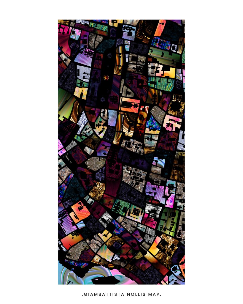
The graphic is a personal project undertaken to understand and explore the Nolli’s Map of ‘Rome’. The two maps are patterned versions of the otherwise monochromatic figure ground map of the city of Rome. The idea looks at experiencing spaces rather than buildings. This personal exercise looks at using different digital patterns(self created, and collected) for different buildings signifying character that is otherwise not shown with a single colour hatch. This adds another interesting layer to the reading of the map, and shows the idea of diversity in building and spatial forms.
The map is a powerful tool to understand the idea of city and place making. Giambattista Nolli’s map of Rome, drawn in 1748 is a renowned figure ground drawing. The first of its kind, the map embodies one simple idea – the idea that a city may be conceived and experienced as a series of enclosed spaces, primarily streets, squares and the insides of public buildings, rather than as a series of objects.
- Comment
-
Subscribe
Subscribed
Already have a WordPress.com account? Log in now.
