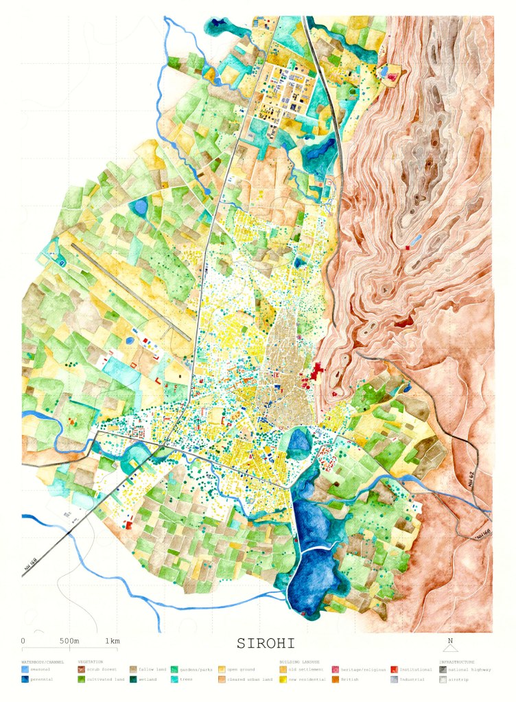
Historic Indian towns are in varying degrees of negotiation with their landscape, evolving into unique models of city form. Sirohi, a town in Southern Rajasthan, is one such place that was conceived under Rajput governance in the early 1400s and briefly passed over to the British Raj. Terrain and ecology have always been the primary deciding factors that govern the laying out of a settlement, its nucleus and axis. With the added pressure of global forces, migrant economies, exponential densities and social pluralities, have our cities expanded in desperate panic, replacing forest with farmland and farmland with brownfields?
Mapping was thought to be an important tool to conduct an enquiry into the flux that Sirohi is going through – strands of deterioration and neglect in the old fabric, coupled with continuous expansion of the city periphery. This drawing was created by digitally tracing out maps available with the Nagar Parishad of Sirohi and tallied with Google Satellite images at every step. It was then printed on an A1 size sheet and hand-rendered with watercolours to depict the natural features and landuse of the region.
